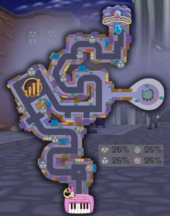
Street M.A.P.S.

Street M.A.P.S. (Marvelously Animated Pathfinding System) is a system invented by Loony Labs that allows Toons to open a street map so they can view where they are on the street as identified by a blue arrow, view ToonTask destinations, view percentages of Cog departments, and view Cog Buildings and Sellbot Field Offices. While on a street, a Toon can open a street map by pressing the "View Street Map" hotkey (set to the Alt key by default) or clicking the street map icon that appears when the Shticker Book is hovered over.
When a street map is opened, a red numeral symbol indicates a Toon Building or location that is needed for a ToonTask. If a Cog Building is in place of a Toon Building, the numeral symbol turns grey. Right beside the map is a table displaying percentages of Cog departments and depicting their emblems. As in the percentage table, the emblems indicate existing Cog Buildings pertaining to Cog departments. There is also a unique emblem that indicates an existing Sellbot Field Office.

